THE ROMAN BRIDGE OF LUGO – MOBILE LIDAR AND GPR SURVEYS
Surveying the Roman Bridge of Lugo with a mobile LiDAR system and GPR, before its imminent rehabilitation. We intend to compare these results with those previously obtained with the TLS.
This bridge is composed by granite and shale masonry. From the interpretation of the field GPR data, it was possible to conclude that areas in the stonework composed by shale can be identified as those areas where the electromagnetic signal shows significant attenuation. Observing the radargrams acquired, some arches are not detected by GPR, which indicates the existence of shale masonry in the vault of the arch and/or adjacent areas. Because of the bridge has undergone several reconstructions throughout its history and there is no uniformity regarding to building materials, the GPR profiles were collected through different sides (A and B) of the pathway to analyze the influence of the building materials over the electromagnetic signal with more detail.
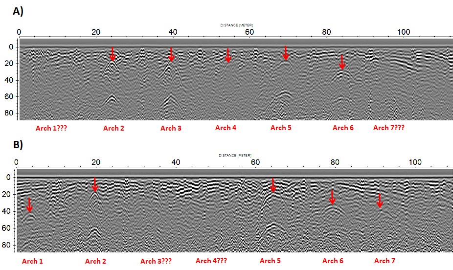
Radargram collected with the 250 MHz shielded antenna
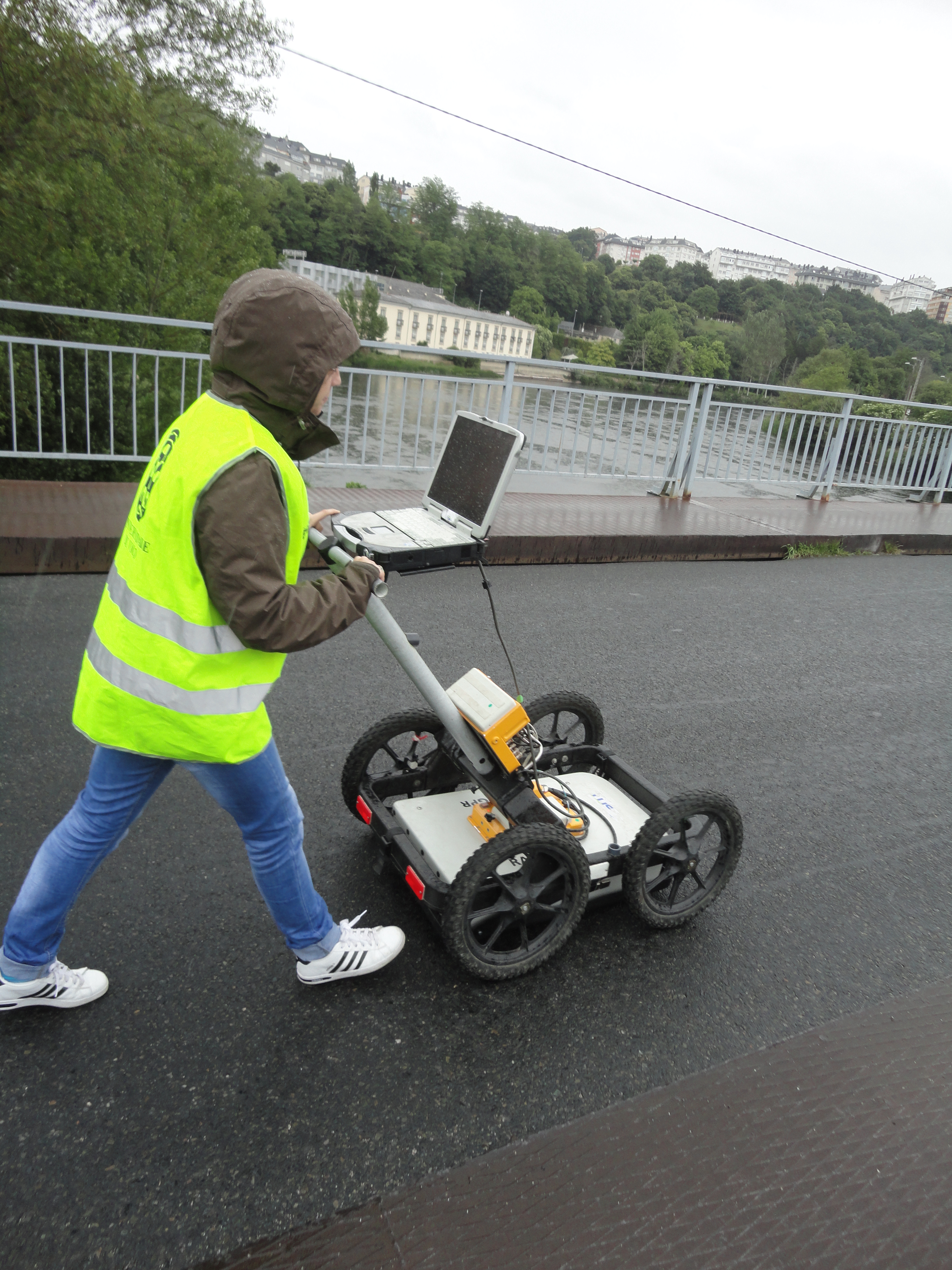
GPR on-site survey
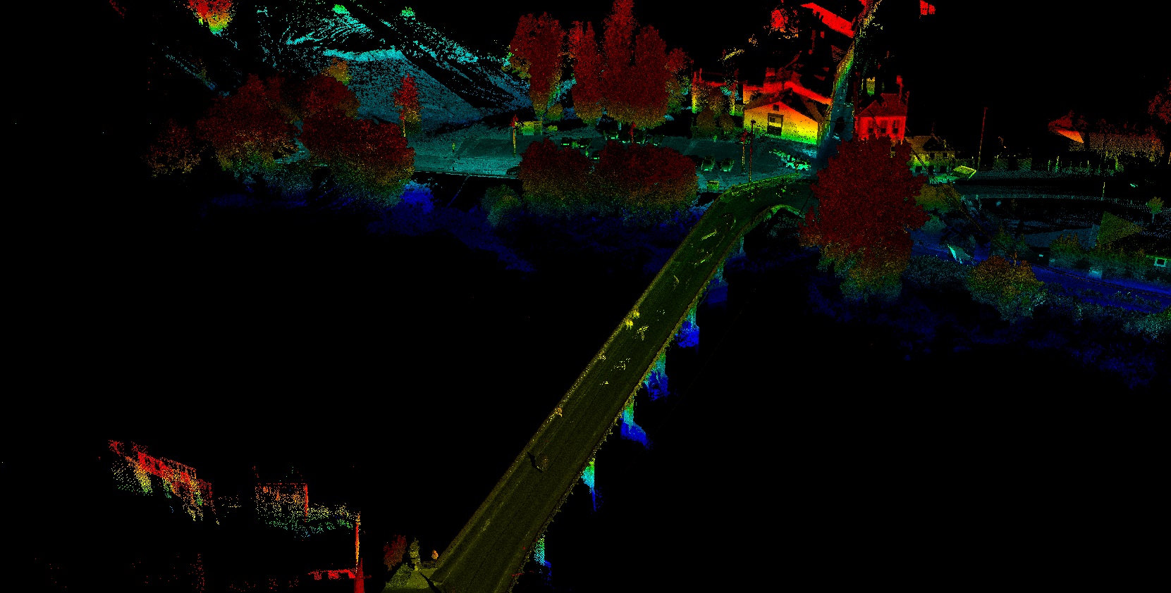
Bridge point cloud acquired with the LiDAR system